2. The distance ahead is:
As shown in Fig. 2, A and B are control points with known coordinates, and P is the point to be sought. The distances Sa and Sb have been measured by the total station at points A and B, respectively.

We can also use the AutoCAD system software to draw two points A and B according to the coordinates of A and B. Connect the AB point to get the AB line segment, then take the points A and B as the center and Sa and Sb as the radius. Circle, then get P point and P' point (according to the position of the scene, from the map can be intuitively identified that one point P is the request, and the other point P' is the virtual point, which we do not need). Use the ID command to select the intersection point P, you can get the P point coordinates. In the actual work process, we usually combine the front angle measurement intersection with the front distance intersection, of course, it is not necessary to complete all the conditions. In addition, for the application of the above coordinates to the coordinates, it should be noted that the coordinate order in AutoCAD is different from the geodetic coordinate system in our measurement, that is, the corresponding relationship between the X coordinate and the Y coordinate.
3. Management of operation materials:
In addition to the advantages of measuring internal data in engineering, AutoCAD has a very wide range of applications in the management of field data. As a well-known engineering application software platform, AutoCAD has been familiar with and mastered by engineers and technicians. In the measurement of field data, it is mainly the management of the control point network sketch and its calculation data, on the other hand, the drawing of various excavation cross-sections, longitudinal section drawings, and the calculation of cross-sectional area, as well as other required drawings. Drawing. Because AutoCAD already has strong mathematical calculation function and high mathematical precision, its effective digits can fully meet our needs in engineering measurement. During the operation of the Yele Power Station, we will classify all drawings, all engineering quantities and documents. The main point is to use AutoCAD to draw the general drawing of the drawing documents. In the future work, we can search on the general drawing. It is.
4, application examples:
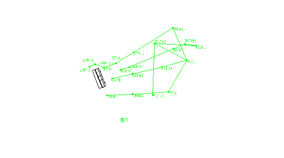
Now combined with our actual work, we made some practical application instructions: We undertook the construction survey work of the Yele Hydropower Plant site pivot project. At the time of entering, we established a first-level wire closed loop. After the observation data is adjusted, we will The geodetic coordinates of the coordinate points are input into the AutoCAD platform, which is shown in Figure 3. Later, as the project progresses, we successively encrypt some of the branch points and input the coordinate results, thus realizing the digital management of the coordinate data in the true sense. This also facilitates future coordinate management, and also facilitates future graphic applications in some special cases. Specifically, according to the structural relationship provided by the design, sufficient construction coordinate system is set up in the figure (which is subject to the need for setting up the station in the field staking) and saved. In the future engineering application, we only need to open the corresponding coordinate system, use the ID command to take the point we need, and the corresponding coordinates will come out.

The following example gives a description: In the intersection of the tailwater tunnel and the tailgate chamber, there is a case where three straight sections sandwich two arc segments, as shown in Figure 4:
Previous page next page
Bluetooth Wifi Controller,Bluetooth Rgb Controller,Wifi Rgb Remoter Controller,Smart Wifi Controller For Led
Shenzhen You&My Electronic Technology Co., Ltd , https://www.szyoumyled.com